Executive summary
Introduction
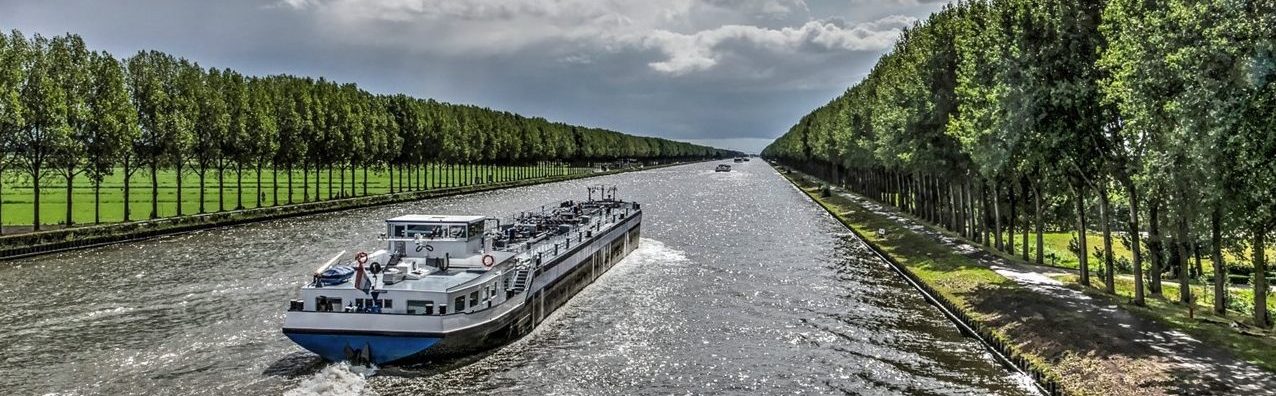
According to NAIADES III, the use of the EU’s inland waterway network is currently not optimised due to the lack of coherent infrastructure and fairway quality assurance. Droughts and floods can severely disrupt transport activities by: temporarily blocking waterway sections, imposing restrictions on the amounts of loads transported, and requiring additional vessels to compensate for reduced load factors, or even a shift to other modes of transport. In consequence, under such circumstances, the supply of raw materials and manufactured goods can become insufficient or even interrupted, the transportation costs will increase and the impact on the economy can be dramatic. For example, in the third and fourth quarters of the year 2018, the production losses of the German industry due to persistent low water levels on Rhine river amounted to approximatively 4.7 billion EUR. This corresponds to 0.63 % of the entire German industrial production. Several companies had to cope with substantial production losses, like BASF in the order of 250 million EUR and ThyssenKrupp in the order of 100 million EUR.
In general, in the past 200 years, such low water events occurred regularly, although in the last 50 years these events have become less and shorter lasting. However, also in the light of no climate change such events will happen in the coming decades. Accounting for climate change impacts on the hydrology, it is expected that such events will occur more often in the future, as shown in this report. For example, in the Rhine area (Lobith) the low water event of 2018 is projected to take place every 10 to 20 years instead of once every 60 years till 2050, according to research findings of Deltares. The impact of the past longer lasting low-water events on inland waterway transport was not that strong as in 2018. The reason is that in those times the vessels were smaller and less vulnerable to water-level changes compared to the much larger new ones which entered operation in the past 20 years. This holds also for a part of the pusher and tug fleet on the Danube which displayed initial design draughts between 1.1 m and 1.5 m in the 1960s and 1970s, while the draughts of most later designed and today’s pushers vary between approximatively 1.5 m and 2.2 m, allowing for higher propulsive power, larger convoys and, thereby, for greater energy and cost efficiency of the transport at normal water-level conditions.
Considering these severe impacts on the economy and the inland waterway transport as result of low water, which is being increased by climate change impacts, it is necessary to re-evaluate the logistical concepts in place today, including the size and design of inland vessels, which can improve the vulnerability to climate change in single cases. However, it is stressed that in order to reduce the vulnerability of the entire EU fleet, comprising more than 12 000 operational vessels (PROMINENT (2015)) of which approximately 40 % are assumed to be vulnerable to low water, dedicated infrastructure measures, starting with proper maintenance and management of waterways on short term, have to be considered for improving the climate resilience of inland waterway transport on the long term. If infrastructure measures are neglected, the navigation conditions will become worse as a consequence, and the vulnerability of inland waterway transport to climate change will increase, reducing thereby the service quality of inland waterway transport, which cannot be compensated by newly built vessels or modified logistics concepts, e.g. modified ship operation.
Complementing existing research, this report provides an information package displaying the most recent developments focussed on climate change and infrastructure. It is not directly a guideline for waterway and port adaptation as such guidelines are already existing. Moreover, it can be taken as a guide to most recent guidelines, complemented with selected examples for climate change adaptation deemed important, assisting thereby waterway and port managers in their efforts to cope with climate change impacts. A concise state of the art on this issue became available through the realisation of the PLATINA 3 Stage Event 3 (Brussels Sessions), see also Annex 1 of this report.
Developments in meteorology and relevant weather phenomena
Temperature
The global average temperature will increase significantly by the end of the current century. How much the exact increase will be cannot be said with 100 percent precision, but there is very high agreement in the scientific community that the climate will become warmer. The different studies consulted further suggest that this warming will have different regional impacts. While the temperature increase will be gradual from the northwest toward the southeast, it appears that global warming will also have a greater regional impact on the Danube river basin than on the global average.
Precipitation
The statements on the future change of precipitation are much less accurate than those on the future change of temperature. There is a small consensus that, at least in the Danube river basin, summer precipitation will decrease and winter precipitation will increase. However, even these statements are not universally valid. Due to high regional differences and a lack of nationally available data, especially from Southeastern Europe, it is very difficult to predict the future precipitation change for the whole continent.
Low water
Low water periods on European waterways will in all likelihood occur more frequently and last longer in the future. The seasons in which these periods occur more frequently may also shift from the winter months to the summer months. Reasons for all these changes, among others, are likely to be the higher average temperatures and the resulting increased evapotranspiration values. Another effect that is conducive to low flows is precipitation deficits over a longer period of time. The extent to which this effect affects future low flow trends is also subject to great uncertainty due to the uncertainty in the field of precipitation forecasting. One effect that has so far enjoyed rather marginal status in the literature, but which could promote low water in the future, especially in Southeastern Europe, is water withdrawals. Overall, the forecasts indicate that low water periods will change little until the middle of the current century, but there are increasing indications that more and longer low water periods are to be expected towards the end of the century (see also Fig. 1).
Figure 1: Compilation and projections of low flow carried out for the Rhine, Main and Upper Danube, presented for three time periods 1989-2018, 2031-2060 and 2071-2100. Horizontal line in bar = median value (50 % of projections are above it and 50 % of projections are below it); strongly coloured bars = 15 % of projections fall below this area, 15 % of projections exceed this area => 70 % of projections fall in this area; lightly coloured bars denote minimum and maximum values of all projections (all projections fall in this range). Source: slide from Nilson and Klein (2022).
High water
For the future high-water situation on European inland waterways, the picture that emerges from the data is not a clear one. Although trends can be identified that suggest a shift in seasonality in the occurrence of high-water events towards the winter months, accurate forecasts are increasingly difficult to make the further one looks into the future. Due to the hydrometeorological changes influenced by climate change, it can be assumed that on average the number of days on which there will be navigation-relevant restrictions due to high water will increase. At mid-century, the changes are expected to be moderate but significant. Towards the end of the century, the dispersion of the results will be larger, but here, too, the trends point in the direction of an increase in the number of high-water days.
Ice
It is to be noted that not all waterways are affected by the occurrence of ice. E.g. on the Upper and Middle Rhine navigation has not been suspended due to ice since at least the 70s of the 20th century.
In summary, it can be said that shipping-related restrictions on European waterways due to river ice will decrease in the future, although they will still occur in the distant future. The literature suggests that air temperature below 0° C and ice formation on rivers are correlated and that, taking into account the future change in air temperatures, it is reasonable to assume that ice will be less likely to affect inland navigation negatively in the future.
Visibility
While there are changes in the frequency of sight-restricted days on European waterways, the apparent correlation with climatic change does not sufficiently explain the changes in fog occurrence. There are several hypotheses that try to explain the reasons for these changes, but not all of these reasons are climatic. In essence, there is still a need to catch up in the area of visibility on the waterways when it comes to relevant data, although the visibility has improved on the Rhine and the Main starting from the 1970s.
Wind
As already stated in EWENT (2011), wind gust is one of the most difficult variables for numerical models to predict and there are large differences in how they are parameterised in the Regional Climate Change models (RCMs). Therefore, for wind extremes, changes are expected to be fairly uncertain, with larger discrepancies among different models. Some pessimistic projections of the report indicate a slight increase of wind gusts of 17 m/s for Rotterdam and Amsterdam for the period 2041 – 2070. In general, negative developments for inland waterway transport on the main inland waterways due to changes in wind gusts are not projected. However, it is noted once again that a valid conclusion on the occurrence of wind gusts with negative effects cannot be drawn.
For completeness, results with respect to surface wind change of the latest version of the IPCC WG1 Interactive Atlas are given for the Mediterranean, Western and Central Europe, and Northern Europe. The results display changes in percent derived from comparisons of long-term projections (2081-2100) of surface wind velocities with the ones of the period 1995 – 2014, using the SSP5-8.5 climate scenario and CMIP6 model projections. In general, no significant increase in surface wind is obtained for the European main land with waterways (the median stays in the range of 0 %), being in line with the results of EWENT.
Sea-level rise
Using the SSP5-8.5 climate scenario and CMIP6 model projections carried out for the long term (2081-2100), the changes in sea-level rise derived from the latest version of the IPCC WG1 Interactive Atlas compared with the one of the period 1995 – 2014 amount to approximately 0.75 m (median), and 1.35 m (maximum) for the Mediterranean, as well as Western and Central Europe till 2100.
For Northern Europe, the median of sea level rise amounts to approximately 0.47 m, and the maximum amounts to approximately 1.2 m till 2100.
Impacts of climate change
This report gives a comprehensive overview of the impacts of climate change effects on the performance of inland waterway transport, the infrastructure comprising waterways and ports, as well as the economy relying on inland waterway transport. A quick overview of impacts with threshold values for extreme weather events relevant to inland waterways and inland waterway transport is given in Annex 2 of this report.
Inland waterway transport
The reliability of navigation can be negatively affected by high water events and ice, resulting in suspension of navigation. However, the most important climate relevant phenomenon having an impact on the performance of inland water way transport is the occurrence of low water causing the following impacts:
- The cargo carrying capacity will be reduced, which is depending on the ship size: larger vessels are more vulnerable to low water than smaller ones if the load factor is considered.
- The power demand and fuel consumption increase due to increased resistance and reduced propulsive
efficiency and therefore the emissions increase.
- The vessel speed decreases and the sailing time increases.
- More vessel movements will be necessary for the transportation of the same amount of cargo.
- The manoeuvrability becomes worse, which is depending on the ship type. In certain cases, also positive
effects can occur.
- The stopping duration and distance increase due to higher risk of ventilation, reduced thrust and a greater added mass.
- Starting the movement and operation of a vessel may be prevented by ventilation of the propeller, resulting in a reduction of the thrust.
- The safety of navigation is reduced due to greater risk of grounding and more vessel movements at low water. In addition, wind, high water, reduced visibility due to cloudiness, precipitation, position of the sun or fog and ice flow may cause weather-related accidents.
- The transportation costs per tkm and freight rates increase.
- Finally, goods will be shifted to other modes of transport, which will be difficult to revert, as well as which can cause capacity limitations of climate-mitigation relevant infrastructure like railways.
Inland waterway infrastructure
Weather phenomena with relevance to inland waterway infrastructure are ice occurrence and high water.
The occurrence of ice as a result of long-lasting periods with temperatures below zero degrees Celsius may damage navigation signs leading to reduced safety of navigation, but also the waterway infrastructure e.g. locks may not be operated anymore due to ice jams clogging the lock area or due to freezing of moving parts and mooring devices. In general, it may be expected that the infrastructure related consequences due to ice will be become less severe in the future as a result of global warming and warming trends in water temperature.
Long lasting heavy precipitation solely or in association with snow melt will result in increased discharges, flow velocities and water levels having a significant impact on the inland waterway infrastructure in severe cases. In the worst case, flooding endangering the property and lives of human beings can be the consequence. The most common impacts are:
- significant changes in sedimentation and river morphology;
- driftwood, fallen trees and clogging by drifting items at and on river banks as well as on tow paths;
- aggradation in ports and the fairway as well as at port entrances, berths, river junctions, and pipes;
- damage of river banks, training walls, flood protection dams, bridges of tributaries, tow paths, signs, stairs, ramps and gauges;
- scour occurrence at paths and river banks.
The occurrence of low waters may lead to changes in the sedimentation and aggradation processes compared with normal or high-water conditions. However, due to the associated low flow velocities changes in riverbed morphology may be expected to remain small once low water has occurred. Problems with low water are increased by ongoing erosion in parts of the river bed. Low water in combination with erosion can lead to a restriction of the space available for navigation. To waterway infrastructure operators the consideration of low waters is of importance in order to create strategies and to take proper actions for the provision of navigation conditions according to international agreements, where infrastructure adaptation measures will play an important role.
Due to higher temperatures waterway-infrastructure engineering structures, like moveable bridges and lock gates, might jam or not close fully.
Ports
Ports are important economic actors – at local, national, regional and international level – that have been identified as being vulnerable to climate changes, and as such both seaports and inland ports have been particularly affected by climatic conditions in the recent years. Once a vessel reaches the port, ship manoeuvres and port operations can be hindered by the weather conditions related to wind, water levels caused by low and high waters, wave height, heat waves, rain, fog, ice, riverine and pluvial flooding, etc.
Extreme precipitation leading to floods, as well as the lack of precipitation leading to droughts are the meteorological phenomena with the biggest impact on inland port operations, carrying the risk of decreasing, in extreme cases even paralysing, the activity in most European inland ports and along the inland waterways.
For seaports, rising sea/river levels, increasing intensity of storms, increasing wave height surmounting breakwater design levels, and heavy rain above quay well drainage capacity increase the risk of flooding, demanding respective flood protection measures, e.g. the installation of flood protection entrance gates.
Drought in association with inland waterway transport results in a higher number of motorised vessels and lighters to be loaded and unloaded. A continuous arrival of vessels can be the consequence, leading to increased demand of mooring of vessels and higher traffic in the port. Longer sailing times of inland vessels may result in missing the departure of a sea-going vessel, demanding more capacities for storage of the cargo transported.
Similarly to inland waterways, sedimentation and aggregation of the port area can be a consequence of extreme weather, e.g. floods, demanding regular monitoring and dredging of port areas and their entrances.
Economy relying on inland waterway transport
- The supply of raw materials and transportation of manufactured products can become insufficient or even interrupted due to e.g. low water.
- Significant losses in production amounting even to several billion EUR in Western Europe can occur.
- Finally, companies may consider the relocation of production and distribution facilities, resulting in losses to the local economy and endangering working places there.
Adaptation strategies
Infrastructure adaptation strategies with respect to inland waterway transport relate to the maintenance, improvement and extension of inland waterways, which should always be accomplished by taking the following two main aspects of inland waterway infrastructure development into account:
- economics of inland navigation, i.e. the connection between the existing waterway infrastructure and the efficiency of transport;
- ecological effects of infrastructure works, i.e. balancing environmental needs and the objectives of inland navigation (integrated planning).
A truly integrative waterway management system must be the objective to be reached. Essential features for integrated planning are:
- identification of integrated project objectives incorporating inland navigation aims, environmental needs and the objectives of other uses of the river reach such as nature protection, flood management and fisheries;
- integration of relevant stakeholders in the initial scoping phase of a project;
- implementation of an integrated planning process to translate inland navigation and environmental objectives into concrete project measures thereby creating win-win results;
- conduct of comprehensive environmental monitoring prior, during and after project works, thereby enabling an adaptive implementation of the project when necessary.
Climate proofing of infrastructure in the period 2021-2027
On 16.9.2021, the European Commission published the COMMISSION NOTICE – Technical guidance on the climate proofing of infrastructure in the period 2021-2027 in the Official Journal of the European Union C 373 (European Commission (2021)), setting out common principles and practices for the identification, classification and management of physical climate risks when planning, developing, executing and monitoring infrastructure projects and programmes. It shall give technical guidance on the climate proofing of investments in infrastructure, covering the period 2021-2027.
It is aligned with a greenhouse gas emission reduction pathway of -55 % net emissions by 2030 and climate neutrality by 2050. It follows the “energy efficiency first” and “do no significant harm” principles, and it fulfils requirements set out in the legislation for several EU funds such as InvestEU, Connecting Europe Facility (CEF), European Regional Development Fund (ERDF), Cohesion Fund (CF) and the Just Transition Fund (JTF). It also integrates climate-proofing with project cycle management (PCM), environmental impact assessments (EIA), and strategic environmental assessment (SEA) processes, and it includes recommendations to support national climate-proofing processes in Member States. In short, the guidance is compulsory for all EU funded projects, and it is recommended to be applied also to small projects and nationally funded undertakings.
Both issues are to be taken into account: mitigation of climate change demanding carbon footprint considerations according to updated methodologies of the European Investment Bank (European Investment Bank (2020 b), (2013)), as well as adaptation to climate change associated with a vulnerability and risk assessment. The basic idea is to take climate change effects into account already in an early stage when mitigation or adaptation measures can be relatively easily and at a lower cost implemented. Later infrastructure interventions are usually associated with high costs and more difficult to be realised.
Climate change adaptation planning for ports and inland waterways
In 2020, PIANC (The World Association for Waterborne Infrastructure) published the PIANC Report 178 CLIMATE CHANGE ADAPTATION PLANNING FOR PORTS AND INLAND WATERWAYS (PIANC (2020)). It is a very comprehensive guidance document of the PIANC’s technical Working Group 178 providing a brief introduction to the potential consequences of climate change and some of the challenges to be addressed in consequence if ports and waterways are to be adapted effectively. The guidance is focussed on the existing infrastructure, giving practical guidance to infrastructure operators, as well as setting out a portfolio of impact-specific measures and case studies.
For practical use, the report contains a table with generic measures strengthening the resilience or adapting assets, operations or systems, as well as a comprehensive set of measures is given with respect to numerous climate change impacts. They were identified through an extensive international engagement exercise involving Working Group members and their colleagues from 14 countries; running workshops in Europe (UK, Norway), Asia (The Philippines), Africa (South Africa) and America (USA); and input from several international associations (International Maritime Pilots’ Association; International Harbour Masters’ Association; European Sea Ports Organisation, UNCTAD and others). The measures considered relate to:
- rainfall-related or groundwater flooding (see Annex 3A);
- flooding due to overtopping (see Annex 3B);
- high in-channel river flow velocities or changes in sea state (see Annex 3C);
- low flow or drought (see Annex 3D);
- changes in sediment or debris regime (see Annex 3E);
- bed or bank erosion (see Annex 3F);
- reduced visibility (see Annex 3G);
- change in wind characteristics (see Annex 3H);
- extreme cold, ice or icing (see Annex 3I);
- extreme heat (see Annex 3J);
- changes in ocean water acidity (see Annex 3K);
- changes in salinity or salt water intrusion (see Annex 3L);
- changes in vegetation growth (see Annex 3M);
- changes in species migration or range (see Annex 3N);
- changes in native species survivability or growth rate (see Annex 3O);
- introduction or spread of invasive, non-native species (see Annex 3P).
Proactive waterway maintenance
Continuous maintenance works, e.g. dredging, constitute a non-structural measure carried out by waterway administrations in order to maintain the required fairway parameters. Dredging works have to be contracted and assigned. Right before and after dredging measures in the fairway, the intervention areas are surveyed to enable monitoring of the works as quality control. The prioritisation of dredging activities within a defined time frame at the beginning of the annual low-water period constitutes one of the most important measures. If low water periods will change with regard to their seasonality due to climate change in the future, the dredging strategy has to be adjusted accordingly, comprising one cost-efficient adaptation measure to possible climate change impacts. In order to reduce the number of necessary interventions for the sake of ecology, amongst others the water depth to be provided at low navigable water level (LNWL) may be also changed, e.g. from 2.5 m to 3 m, reducing thereby the number of interventions to e.g. one per year, allowing for minimum impact on fauna and flora, as well as preservation of biodiversity for the rest of a maintenance year as the sensitive layer of 20 to 30 cm of the river bottom will be manipulated least. Done properly substantial savings of volume to be dredged, as well as maintenance costs can be achieved.
Provision of information on the waterway
The availability of sufficient personnel resources and modern surveying equipment (i.e. surveying vessels as well as software and hardware for data processing and analysing) is the basis for proper collection and provision of comprehensive information on the topography of the fairway and the corresponding water depths relevant for navigation. This information is of particular value in shallow water stretches of the waterway where regular surveying activities have to be carried out. The full picture on the topography allows vessels to choose a route within the fairway with sufficient water below the keel, even if the water depth is not sufficient over the entire width of the fairway. This way, the fairway can be optimally used. In addition, the vessel may choose also the route with greater water depths reducing the resistance and corresponding fuel consumption. Finally, the information gained can be used also for the monitoring of effects of rehabilitation and river engineering measures, as well as detection where maintenance and waterway management activities are necessary. For this purpose, also regular inspection trips with surveying vessels, being equipped with e.g. a single-beam echosounder, have to be carried out over longer distances of the river in order to get a first idea where shallows have established and where more detailed surveying, e.g. by multi-beam equipment, will be necessary.
In addition, measurements of water depths or the river bottom performed on commercial vessels in operation can be used at locations where no or rare surveying results are available, e.g. via shipborne equipment. For this purpose, the CoVadem initiative can be applied, which is a commercial monitoring network comprising a growing fleet of over 200 vessels currently mapping out the latest data on depths and bridge clearances on the river Rhine. Additional developments were carried out in the H2020 EU project PROMINENT, where two different systems were created for the determination of navigation conditions by shipborne measurements performed on board commercial vessels. The first one was applied in three vessels sailing on the Rhine, the second one was applied in ten different pushed convoys sailing on the Middle and Lower Danube, both giving promising results, demanding, however, further activities for roll-out.
Usually, water level forecasts of only a few days e.g. one up to two days have been sate of the art. Within the Horizon 2020 EU project IMPREX, forecast products for the River Rhine – Europe’s most important waterway – and the German parts of the waterways Elbe and Danube, covering different lead times have been developed by the Federal Institute of Hydrology (BfG) of Germany. The forecast products available at the time of writing this report comprise:
- a deterministic 4-day water-level forecast (www.elwis.de);
- a probabilistic 10-day water-level forecast developed for the waterway Rhine (www.elwis.de);
- a probabilistic 6-weeks prediction (BfG to be contacted, operational in July 2022);
- a probabilistic tree-month estimate: still under research.
The products developed by BfG constitute a remarkable step forward. However, it has to be noted that the reliability and lead time of water level forecasts is depending on the characteristics and dynamics of the river and its catchment, meaning that one forecast product working well for one river may not work well for another river. In addition to improved water-level forecasts, BfG provides a comprehensive Climate Change Service, available at https://www.das-basisdienst.de/DAS-Basisdienst/DE/sub2_bfg/bfg_node.html .
Means for provision of the information to the users of waterways can be Notices to Skippers, River Information Services, websites, ECDIS, and locks etc.
River-engineering measures and novel approaches
Classical river-engineering measures comprise the installation of groynes, training walls, and rip-rap amongst others, having an impact on the hydro-morphological characteristics of the river, e.g. sediment transport or water flow velocity, and influencing its and the fairways general dimensions, e.g. width and depth.
The following measures contribute to the improvement of navigation:
- optimisation of existing low water regulation to increase its effectiveness, to reduce sedimentation in groyne fields and to reduce maintenance efforts;
- dredging and defined reintroduction of material leading to a sediment balance (sediment nourishment, see also Nature Based Solutions);
- relocation of certain sections of the existing fairway in order to make use of deeper zones for navigation purposes. This measure also reduces the requirement for dredging.
- Granulometric riverbed improvement. The reduced transport of bed load also reduces the need for maintenance dredging.
An approach deviating from classical river-engineering installations is currently being planned in Austria and deals with the use of so-called “mobile groynes”. In order to counteract the potential effects of climate change on the waterway in the least invasive way possible, in harmony with nature and yet with a focus on optimal fairway conditions, viadonau is investigating and testing a combined concept of small-scale, dynamic measures. Flexible hydraulic structures in the form of loaded hulls, e.g. lighters will be tested, which are strategically positioned in the vicinity of shallow areas in order to provide additional fairway depths in the event of low water by creation of higher flow velocities transporting the sediment and gravel away from the shallow. The dynamics of the river are used for this purpose which may be considered also as Nature Based Solution. The idea is that in the case of low water, the fairway depth can be increased with the help of the “mobile groynes”, but in the case of high and normal water levels (i.e. when the “mobile groynes” are not needed) the flow velocity is not unfavourably influenced as the position of the groynes can be modified accordingly.
Nature Based Solutions
Nature Based Solutions are not new. Mackin mentioned as early as 1948 in his “Concept of the Graded River,” ” … working with rivers rather than working on rivers …” (Mackin (1948)). He described even at that time that all one had to do was to take advantage of the natural processes of the river. This concept has several names meaning the same: Nature Based Solutions, Building with Nature, Engineering with Nature, Natural Flood Risk Management, and several more. They have many benefits besides flood risk reduction: for example, in terms of agriculture, recreation, and habitat in general. There are many guidelines with best practices and examples, but they are not yet widely used. Ventures are often in a pilot phase and need to be scaled up to become mainstream. However, this is a rapidly growing field in science and application. Nature Based Solutions are defined as measures reflecting a “working with nature” approach; they mitigate flood risk while being cost-effective, resource-efficient, and providing multiple environmental, social, and economic benefits. The International Guidance Document on Natural and Nature-Based Features for Flood Risk Management was published in August 2021 (Bridges et al. (2021)). This document is a very comprehensive guideline providing practitioners with the best available information concerning the conceptualisation, planning, design, engineering, construction, and maintenance of natural and nature-based features to support resilience and flood risk reduction for coastlines, bays, and estuaries, as well as river and freshwater systems. It contains five parts dealing with fluvial systems. It is not an instruction guide, but it offers suggestions and insights into benefits and best practices, as well as an eleven-step checklist for fluvial systems.
In general, the solutions to be applied will be mixed solutions, i.e. green (natural), green-grey, and/or grey (traditional engineering). If done in the right way, they can contribute to overall well-being. Nature Based Solutions can be linked to the United Nations Sustainable Development Goals (SDG). However, for this purpose, impacts must be measurable and an assessment framework must be in place, allowing for monitoring and making adjustments. A methodology to this effect was published in Andrikopoulou (2021).
Canals
In general, canals display rather constant navigation conditions as water levels remain almost constant and flow velocities relatively low close to zero. The most relevant weather event is the occurrence of ice, which can result in suspension of navigation extending over several days up to several weeks. With respect to this issue, it is projected that climate change will have positive effects, resulting in less frequent and shorter lasting ice events. Although canals are expected to be rather insensitive to further direct climate change effects, in severe drought periods, problems can arise also there as they are fed by river water and extractions may take place for other economic and societal functions, and adaptation measures have to be taken. For example, in the case of the new locks in the Albert Canal in Belgium, large Archimedes screw pumps at six lock systems were installed. In the case of a drought, water is pumped upstream to replace the water lost by the ships passing through the lock. In the case of an excess of water, mainly in winter, the pumps are used as a bypass and also generate hydroelectricity.
Ports
Climate resilience of ports is characterised by the ability to prepare for and adapt to changing weather conditions and withstand and/or recover rapidly from disruptions, with the aim of ensuring continuity of services and movement of goods to, from and through ports.
There is no single approach to climate change adaptation and resilience planning for inland ports. Inland ports shall start by drawing up policies and strategies to identify climate-change risks, and also come up with scalable action plans that can be applied over time.
Climate change is the second environmental priority of ports after energy consumption, according to the 6th Environmental Report by the European Sea Ports Organisation (ESPO) published in 2021. In 2021, the share of ports that are taking steps to strengthen the resilience of their existing infrastructure in order to adapt to climate change remains stable compared to 2020 (65 %), and 53 % of them has already faced operational challenges due to climate change. Meanwhile, ports put greater emphasis to climate change adaptation as part of new infrastructure development projects.
A comprehensive set of adaptation measures dedicated to ports is given in PIANC (2020).
Selected examples of implemented adaptation measures are given for inland ports in Austria, Croatia, Slovakia, Hungary and Romania, as well as the Port of Rotterdam comprising Botlek and Vondelingenplaat, Waalhaven and Eemhaven area, Merwe-Vierhaven area, Europoort, and Maasvlakte.
Recommendations for further development and research
With regard to policy needs, it is noticed that the amount of research and pilot work needed to test new solutions for inland waterways to adapt to the changing climate is underestimated when it comes to research and development. The conduction of one research project, or the consideration of only inland waterways in the direct hinterland of maritime ports is not sufficient in order to arrive at a climate resilient inland waterway infrastructure, although it constitutes one important step forward. Moreover, a continuous consideration of the topic is necessary as the framework conditions are subject to continuous changes, new critical locations evolve, as well as new approaches adapted to local conditions can be developed.
As this report shows, meanwhile, some research and development has been carried out. However, this mostly on a local level, e.g. the KLIWAS programme for the German waterways, or Climate Resilient Networks for the Dutch waterways. A comprehensive picture with a common climate modelling basis is still missing, in particular for the Danube region, calling for climate change projects on European level involving all relevant representatives of member states concerned. The following items shall be considered and where possible more in detail on a local level:
- creation of a common data basis with respect to climate projections (temperature, precipitation, discharge, water depth, water temperature, …) and impacts relevant to inland waterway transport, the environment and possible users of waterways, as well as local economies, e.g. the Danube region which has not been considered yet;
- forecasting for improved utilisation and management of the waterway: extension of existing lead-times and improvement of reliability by deterministic short-term predictions, as well as probabilistic mid-term and seasonal predictions (e.g. 3 month);
- investigation of interrelations between developments of surroundings of waterways, land-borne activities and the ones on waterways, e.g. impact of water withdrawal for agriculture, or sealing of land in the vicinity of waterways, etc.;
- review, elaboration and testing of maintenance approaches with respect to their appropriateness and how they can be improved;
- review of fairways and navigation channels, as well as evaluation where relocation of fairways and marking are meaningful;
- application of Nature Based Solutions:
- promotion of main streaming;
- evaluation of which and where they can be applied, e.g. creation of natural canals in a river delta with a lot of sedimentation;
- development and testing of innovations e.g. flexible waterway infrastructure, eventually considering lessons from the past;
- in general, research on river engineering and waterway management options for provision of reliable and predictable navigation conditions;
- usage of aquatic and flying drones for collection of information on developments in fairways and wide waterways at low water for determination of e.g. new routes suitable for navigation;
- water management, extension of existing water reservoirs and implementation of new water reservoirs;
- implementation of the floating-ship-data approach, supporting waterway management, as well as providing improved information on navigation conditions (water depth);
- further development of information systems providing relevant information to operation of waterways and navigation conditions to users of inland waterways;
- promotion of integrative planning of infrastructure projects;
- elaboration and initiation of measures for the reduction of administrative efforts with respect to permissions requested for the implementation of infrastructure projects.
With respect to the adaptation of the infrastructure, a dialogue between the industry, logistics, politics, and environmental organisations, as well as regulations and funding for modernisation on European and national level will be necessary. Proper cooperation between the different stakeholders and an integrated approach for coping with climate change is necessary, what for also the European institutions are needed.